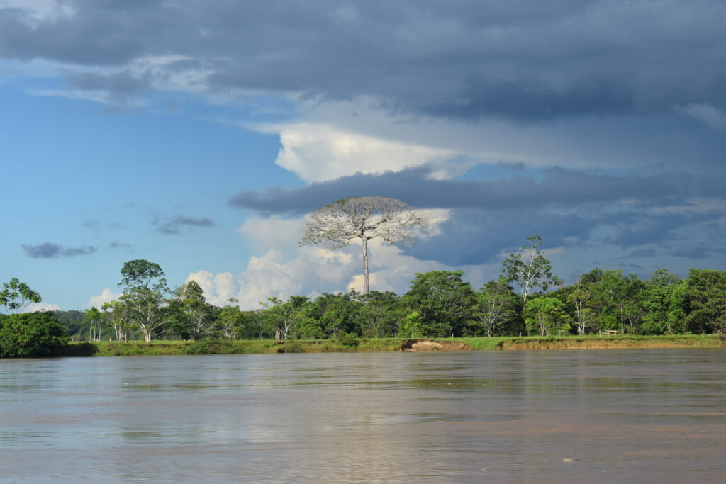
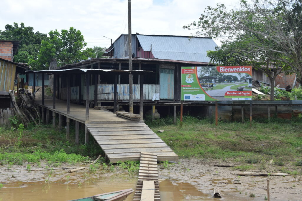
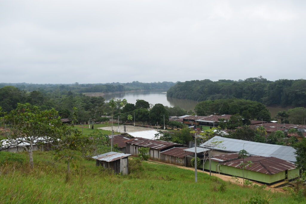
In Remolino del Caguán, what some would call the heart of Caguán, everything seems to be in order: one and two-story homes, several paved roads, the central square, a Catholic church. All of this would suggest an organized community that has grown out of the tradition of abandoned communities on the frontier of the Colombian Amazon.
Paradoxically, what is least stable in this part of the municipality of Cartagena del Chairá is the land, the very land that rural workers roam and work each day. Most families do not own the lots on which they have been raised for generations. Their ancestors arrived from different parts of Caquetá and other departments seeking out better opportunities and incentivized by the state itself which promoted the colonization process.
Even though they act like owners, many do not have formal land titles for uncultivated state lands (baldíos) that were part of the Amazon Forest Reserve or were unable to legalize land tenure given that their land falls inside an Area of Special Environmental Interest, a designation that prohibits land titling.
Land use and ownership in this part of Caquetá intersects with the negligence of agricultural authorities, the armed conflict, and extraction models. It would seem the state has neither the capacity nor the will to identify who owns the land or to control the clear cutting and burning of native forest, the most serious environmental crime faced by the Amazon.
VerdadAbierta.com visited the region and talked with peasant leaders, in addition to consulting with experts and reviewing archives. The result could not be more alarming: a major part of this agrarian disarray was caused by the state itself, with no signs of a prompt solution.
The promised land?
“Caquetá is the site of a major portion of the mistakes that have been made in the country’s land policy,” according to Darío Fajardo, an anthropologist and professor at the Universidad Externado de Colombia. The department’s land problems go back at least 100 years.
According to the academic, the twenties were marked by the adoption of the most inclusive land policies, specifically between 1926 and 1928, when opportunities were opened for small- and medium-scale peasant ownership. This was possible due to agrarian regulations that began to strengthen in that era.
In the text Tendencias historicas y regionales de la adjudicación de baldíos en Colombia (Historical and Regional Trends in the Allocation of Uncultivated State Land in Colombia, Universidad del Rosario, 2015), Juanita Villaveces Niño and Fabio Sánchez detail how the government promoted colonization in this region at the beginning of the 20th century: “Land policy sought to promote an expansion of the agricultural frontier and colonization in a broad sense, that is to say, with a focus on the use and occupation of space rather than redistribution. During this period, laws were also issued with the idea of promoting immigration to distant regions, especially Putumayo and Caquetá in 1913.”
Decrees 839 and 1110, issued in 1928, promoted the colonization of uncultivated state land, opening up the possibility for land to be given to peasants on small tracts and for the state to recognize that the countryside was organized into communities of farm workers.
“This is very interesting because it signaled concern among at least some sectors over land distribution, which followed a hegemonic pattern of large-scale land ownership,” Fajardo notes, adding that even though there were advances in land policies, at the end of the ‘20s actions were limited because throughout history “the correlation of power has been adverse to land allocation.” This scenario began to taper following the administration of President Enrique Olaya Herrera (1930-1934).
Law 200 of 1936 on land management reflected that situation. “It was no longer a law favoring generous land allocations for small-scale farmers, instead it simply formalized property,” Fajardo explains.
During the 1940s there were setbacks along with attacks against the organized peasant communities who had participated in the colonization of the country’s remote areas and who, in the case of Caquetá and other Amazonian regions, were interested in selling white rubber, tobacco, and lumber from the cow tree and cedar. However, the high costs of production and transportation, in addition to competition from other producing countries, made those activities unviable.
Later, in the ‘50s, came the years of “The Violence” and with it, the mass forced displacement of peasants from their land. Fearful and desperate, they looked towards the Amazon with the hope of a new beginning. Caquetá then became an enclave that received peasant migrants by and large hailing from the departments of Huila and Tolima.
Studies from the Instituto Amazónico de Investigaciones Científicas (SINCHI – Amazonian Institute of Scientific Investigation) propose that “land availability and work for the peasant family promised [the opportunity of] resettlement of the population and rebuilding their traditional economy, which would take place in contexts that were geographically, environmentally, and historically different from those of the rural lifestyle in their places of origin.”
It was an abysmal change for the new settlers, given that the soil they were working only had a very thin layer of productive soil, making agricultural production difficult: the harvest cycles were very slow, and it was necessary to let the land lay fallow and then fertilize it to plant again. The option of cutting down sections of the jungle was therefore chosen to continue harvesting and producing food.
The family history of Farid Murcia, a social leader from Cartagena del Chairá, is part of the forced migration mentioned by the academics. His grandfather and father arrived at the Caquetá foothills in the 1930s, escaping the partisan violence they faced as liberals.
Over four days, they opened a trail through the jungle, crossing the eastern mountain range. They came from the municipality of Algeciras, in Huila, and established their ‘fundo’ or plot in the rural community of Santana Ramos, in Puerto Rico, Caquetá. They worked in agriculture and cattle ranching, traveling along rugged trails to sell their agricultural products.
While his grandfather and father confronted the jungle, Murcia finished his studies, became a teacher in his community, and then coordinator of Nucleus 4, an autonomous mode of organizing various rural communities. For years he watched peasant families manage their community needs, but they never formalized ownership of the land they worked.
“Everything in the department of Caquetá has been obtained through grassroots struggle, by the peasants. Here, nobody has given us anything. Nothing means nothing!” Murcia notes when thinking back on his story and that of his neighbors. These communities organized to provide themselves with the services not effectively provided by the state, such as healthcare, education, housing, and infrastructure.
Tensions Over Protected Areas
At the beginning of 1959, the President of the Republic issued Law 2, which regulated the forest economy to protect water, soil, and wildlife in seven of the country’s subregions. It was under this regulation that the Amazon Forest Reserve Area was created with 34 million hectares including large parts of the departments of Amazonas, Caquetá, Cauca, Guainía, Guaviare, Huila, Putumayo, and Vaupés.
But the regulation clashed with the presence of hundreds of families who by that time had already settled in the Caquetá jungle, and those that continued arriving looking for a ‘fundo’ on which to live. In response to these families, the newly created Instituto Colombiano de Reforma Agraria (INCORA – Colombian Institute on Agrarian Reform)—established through Law 135 of 1961—issued Resolution 041 on March 2, 1964, by means of which “a section of uncultivated state land was reserved for special colonization in San Vicente del Caguán and Puerto Rico, Caquetá.”
In other words, a large area of uncultivated state land was excluded from the Amazon Forest Reserve Area to respond to the aims of the peasant colonization that had begun in Caquetá over a decade before.
State errors would soon follow, including the allotment of subsidies for cattle ranching activities in the context of support for colonization, which sought to reproduce the hacienda model used in the Caquetá foothills, a model that had begun to take root at the beginning of the 20th century.
When referring to cattle ranching and monocultures such as oil palm, the SINCHI Institute has proposed in its analysis that “the institutions that oriented the colonization process, such as INCORA, are partly responsible for reproducing models that would later be deemed inappropriate, unviable, and unsustainable in the Amazon.”
Peasants were dissatisfied with state actions at the beginning of the seventies. In reaction to this, the Asociación Nacional de Usuarios Campesinos (ANUC – National Peasant Association) promoted mass protests in Caquetá, no longer over access to land, but for increased state support to complete projects that supported colonization through loans, roads, education, healthcare, and better crop prices.
In the rest of the country, ANUC promoted “land take overs,” including the land of large-scale landowners, with the idea that the land would be acquired by the state and redistributed among landless peasants. The pressure was met with aggression by landowners who began requesting State Security Forces-led evictions. Given their influence, these voices were heard by the administration of then president, Misael Pastrana Borrero.
The pressure from large-scale landowners resulted in what is called the Chicoral Pact, signed on January 9, 1972 at the offices of the Agrarian Bank in Chicoral, Tolima. Some analysts consider that the agreement was a counter agrarian reform project that blocked the possibility of a just distribution of land ownership, accelerating land concentration and generating the mass expulsion of peasants from their territories towards the Orinoco and Amazon.
However, it was not just large-scale landowners who harassed the peasantry for fighting to get ahead. Those who had plots were pressured by emerging illegal armed groups and criminal structures that began extorting peasants, affecting their family economies.
In this context, Eucario de Jesús Bermúdez arrived with his parents to colonize isolated areas of the mid-Caguán region towards the northwest, in what is now known as Campo Verde and Líbano. In 1977, his family was forced to displace from the municipality of Balboa, Risaralda, fleeing from extortionists who wanted to “tax” the coffee harvests managed by his father.
“My dad said: ‘Instead of giving this coffee harvest to that guy, I am going to sell it and we are going to disappear’; and then he told my mother: ‘Let’s go to Caquetá. I have heard there is open land there. Let’s go and find land to work,’” remembers Bermúdez.
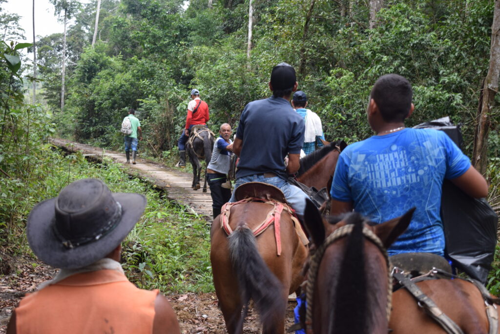
Sure enough, they left Risaralda and traveled to the south of the country, where they obtained a piece of land in the municipality of Cartagena del Chairá. It took an eight-hour boat trip along the Caguán river and another eight hours by foot to reach the land. There, they worked in agriculture once again.
Dire State Management
In the mid-eighties, the subdivision of a large portion of land from the Amazon Forest Reserve Area had been carried out with the aim of legalizing the land of settlers in the Middle and Lower Caguán region of Caquetá.
By means of Agreement 65, issued on September 25, 1985 by the Instituto Nacional de los Recursos Naturales Renovables y del Ambiente (INDERENA – National Institute on Renewable Natural Resources and the Environment), 367,500 hectares of the reserve were subdivided to benefit families living in Cartagena del Chairá and Solano, which represented 22.6% of the 1,620,000 hectares that INCORA initially requested be partitioned.
Two fundamental considerations were taken into account for that decision, according to the agreement: first, that the Middle and Lower Caguán communities were “characterized by a high level of organization through Community Action Councils (JAC) coordinated by the Settlers’ Committee, with 95% coverage in rural communities and settlements.”
Second, the document referenced a “perceptible and growing environmental awareness that has made it possible for the peasants to understand their responsibility regarding renewable natural resources.”
Nevertheless, the task of subdividing this land was not carried out through technical visits to the region, but instead from a desk at INDERENA in Bogotá. The result could not have been worse: the haphazard way in which the area was divided did not correspond to the bends in the river, meaning that there are segments of land separated for titling that are over 28 kilometers from the river, in a straight line, while others are less than 1.5 kilometers.
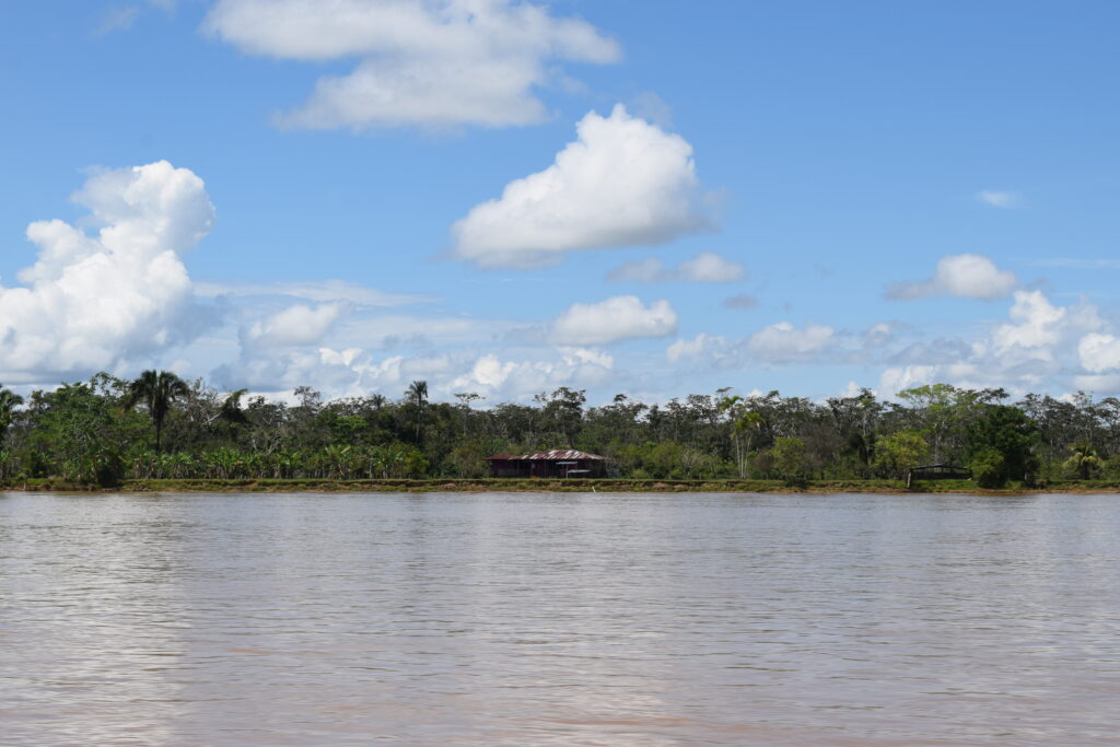
This, however, has not been the only problem hatched in the capital of the Republic. This has been shown by Melquisedec Betancourt who has been leading initiatives in ten rural communities of Lower Caguán, grouped in Nucleus 5, since he was fourteen years old. His efforts to clarify who owns the land have led him to identify farms with land titles in areas that were not partitioned from the Amazon Forest Reserve.
According to his inquiries, just in the rural community of Sardinata Alta, La Holanda, and Panamá Uno, where he is a leader, “20 to 25 families are in the Law 2 area and have a title.” By contrast, of the 18 families living in the rural community of Las Quillas, only one has a property title.
Few Land Titles
This agrarian disarray regarding land tenure and property in Caquetá was affected by a weak peasant economy that lacked infrastructure to sell its harvests and faced limits due to soil use restrictions, leading, in the mid-seventies, to hundreds of farm workers shifting to illicit-use coca leaf crops, in turn promoting new settlements.
This population growth is reflected in DANE statistics on Cartagena del Chairá: between 1985 and 1993, there was a 163% increase in inhabitants in the urban area and a 296% increase in the rural area. Without a doubt, this put increased pressure on the jungle, which succumbed to the advance of the coca leaf.
Statistics from the United Nations (UN) detail that in 2001 Caquetá had 26,603 hectares of coca crops throughout 15 of its 16 municipalities, the most affected of them being Cartagena del Chairá (13,551 hectares), Solano (4,005 hectares), San Vicente del Caguán (1,713 hectares), Solita (1,170 hectares), and Valparaiso (1,240 hectares).
Since the early 1980s, the FARC guerrillas (today demobilized) began “managing” this illicit activity through several of its fronts grouped in the Southern Bloc. They promoted coca leaf crops, regulated the price of coca paste, imposed a tax on coca production, and coordinated with several drug trafficking cartels. Billions of Colombian pesos were generated to finance the war against the Colombian state.
Analysis from SINCHI suggests that, because coca leaf was being grown on many of the settlers’ plots in the ‘80s and ‘90s, interest in land titles diminished. That thesis is corroborated by Eucario Bermúdez, who has been a leader as Nucleus coordinator and president of the Community Action Council in Cartagena del Chairá: “People focused on planting coca leaf, growing coca, and living off the coca leaf. People didn’t think about titles.”
According to Bermúdez, disinterest in land titles was an attitude more common among “the new settlers” who arrived at the end of the ‘80s and the beginning of the ‘90s, attracted by the “coca boom.” A large part of the earlier settlers sought to formalize their plots and obtain land titles.
As the years went by, and in the face of state strategies such as fumigation and substitution of illicit-use crops, there was notable crop reduction and many coca leaf growers left Caquetá. In 2020, according to the UN, 2,076 hectares were registered, the vast majority concentrated in the Lower Caguán region on the border with Putumayo.
Those who remained, many of them descendants of the original settlers, began to take over the abandoned plots, create farms, and to adapt them to cattle ranching, which is currently the most prevalent activity in the Lower Caguán. However, they still had no property titles, which limited their access to bank loans to increase productivity.
“For that reason, we saw the need to demand that the government please send us somebody who could title our lands. INCODER appeared: for some it was for the better, for others for the worse, for me it didn’t do anything,” said Murcia, suggesting that the requisite titling did not advance.
In his opinion, the issue of property “became a very serious problem” beginning in 2017 with the demobilization, disarmament, and reincorporation of the former FARC under the Peace Accord with the Colombian state. A new resettlement process began with the aim of occupying the land.
“When the FARC left the region, people immediately came from other municipalities in Caquetá and from the interior of the country to claim land in the forest reserve, 200 or 300 hectares for just one person,” remembers the peasant leader.
The serious problem recounted by the leader is not just environmental. The reaction of the administration of President Iván Duque (2018-2022) to this new wave of repopulation was Operation Artemisa, a military strategy to fight deforestation which, according to community complaints caused serious human rights violations.
VerdadAbierta.com set out to update data on the number of rural property titles in Cartagena del Chairá and on actions to formalize land in this municipality’s Forest Reserve Area. To do so, information was requested from the Agencia Nacional de Tierras (ANT – National Land Agency), without any response. Even though the corresponding communications office stated that it had a prepared response, by the closing of this article, no response had been received.
Limits Imposed
The concern over regulating occupied land allocated through agrarian reform programs led the Colombian state to issue Law 160 of 1994, by means of which the Sistema Nacional de Reforma Agraria y Desarrollo Rural Campesino (National System on Agrarian Reform and Rural Peasant Development) was created with the aim of “regulating the occupation and use of the nation’s uncultivated lands, administering preferential allocation to low-income peasants.”
This regulation set limits on allocation by means of the Unidad Agrícola Familiar (UAF – Family Agricultural Unit), which is defined as a “basic agricultural, cattle, aquaculture, or forest production enterprise with an extension that, given the agro-ecological conditions of the area and adequate technology, would permit the family to remunerate its work and enjoy an excess that can be capitalized to help form assets.”
In Resolution 041 of 1996, INCORA specified UAF extensions, defining them based on characteristics of land productivity. In the case of Cartagena del Chairá, which was grouped in the area of Altillanura del Caquetá, a range of 86 to 117 hectares was established.
That means that when uncultivated state lands are allocated, the state must do so in accordance with the established UAF and only grant one plot per family to avoid land hoarding.
Bermúdez is a beneficiary and was allocated 117 hectares, according to public deed No. 225 of February 19, 2009, as registered in a notary’s office in Florencia. The paradox resides in that it is inside the Amazon Forest Reserve Area. About 70 percent of the plot is used for cattle ranching and the rest is for preservation.
“In my case, I am really worried about the deed,” comments the peasant leader. “I said ‘not having land and working the land that belongs to the state, no…’. So, I went to INCORA in 1999.” Arguing that he should be a beneficiary of agrarian reform, INCODER granted him the land that he was working after ten years: “and I am one of the people that fall within Law 2 of 59, but like me, there are a lot of people who have titles, deeds.”
“The state does not recognize its own mistakes,” he continued. To get a loan or a title it was obligatory to have opened at least 50 hectares of pastureland,” he says showing the mortgage papers that he received from the Agrarian Bank a year after obtaining his title.
“Where are the work opportunities that the state provides to peasants? Where are the low-interest loans? They make you clear cut and then say that you are responsible for all the problems,” questions Bermúdez.
A detailed revision of this peasant’s property documents reflects institutional disarray regarding agrarian issues and the state’s lack of knowledge about its inventory of uncultivated state lands and their borders. The deed and real estate registry document place the property inside the jurisdiction of Cartagena del Chairá; even the real estate tax is paid in this municipality, but according to what VerdadAbierta.com could establish through georeferencing mechanisms, the lot is actually in San Vicente del Caguán, an area protected by Law 2.
Restrictive decisions
In addition to the UAF limitations on the allocation of land that is classified as uncultivated state land, in 2013, more than 50 years after Law 2 was approved, the Colombian state decided to carry out a zoning and land management process for each of the forest reserves established by the regulation.
By means of Decree 1925 issued on December 30, 2013 by the Ministry of the Environment and Sustainable Development, applicable zoning and land management was adopted for the Amazon Forest Reserve in the departments of Caquetá, Guaviare, and Huila, covering an extension of close to 12 million hectares with the aim of having a better development planning instrument.
Three types of zones were created: “A” is profoundly restrictive as concerns its conservation mission, “B” is a bit more permissive of other activities, and “C” allows agroforestry, silvopastoral, and other economic activity compatible with environmental protection objectives.
This measure affected the peasants of Cartagena del Chairá. A large part of this municipality in Caquetá was characterized as type A, the most restrictive regarding agricultural activities, putting peasants once again between a rock and a hard place.
Regarding this kind of adverse situation for farmworkers, Fajardo, the researcher, highlights that these areas have not had consistent policy: “People simply arrived there, in some cases titles are granted amidst horrible chaos.” How can these difficulties be overcome?
The academic suggests two options: one, advance in the Peace Accord’s implementation, in particular on the parts on Comprehensive Rural Reform, which include in their guidelines “establishing the agricultural frontier and protecting areas of special environmental interest.” To do this, it is necessary to generate alternatives for the peasant population occupying or living alongside this land, striking a balance “between the environment and well-being and good living, under the principles of participation from the rural communities and sustainable development.”
The other option is that an agrarian reform be carried out where “the peasants who have been expropriated, dispossessed, and left landless be granted access to land, not on the edges of the agricultural frontier—in this case, in these forest reserves—but in the center of the country, that is to say, areas with quality soil, access to markets, and infrastructure, something that has been an impossibility specifically since the Chicoral Pact.”
To the academic, the protected areas will be defended if the peasants are reestablished in areas that are apt for production and if they have access to rural property. However, social leaders like Luis Antonio Valencia, a teacher who has been working in the region for 23 years and who coordinates the Municipal Agro-environmental Working Group for the Right to Land in Cartagena del Chairá, feel that the possibility is remote of reorganizing so many families who have made a life on that land.
“Clarity is needed,” noted Valencia. “It is important to look for alternatives to subdivision in some rural communities and land use rights in other areas. Peasants must have documents that accredit them as land holders so that they can be left alone.”
In our next installment: VerdadAbierta.com investigates how and why there was an increase in deforestation over the last four years, who is behind the deforestation, and the results of the state judicial and military actions to respond to the crisis.
This article was produced in thanks to the support of the Asociación Ambiente y Sociedad and with the support of the Municipal Agro-environmental Working Group for the Right to Land of Cartagena del Chairá, Caquetá.